Hamish Visser
Engineering, spatial data, automation and design.
X-Frame
What
I am a Digital Engineer at Taylor Woodrow in London, where I lead the GIS function within the Digital Engineering team and was appointed to Taylor Woodrow's internal Innovation Leader role. The work spans GIS and spatial data, automation in FME, computational design in Grasshopper, and BIM coordination, across highways, rail, renewables, housing and regeneration projects.
How
Most of what I build starts as someone describing a task that takes them a week. The interesting part is usually not the automation itself, it is working out which part of the process is actually load-bearing and which part is habit. I try to build things other people can run without me, which means the configuration lives in a spreadsheet rather than in the code, and the tool has to survive being handed over.
Background
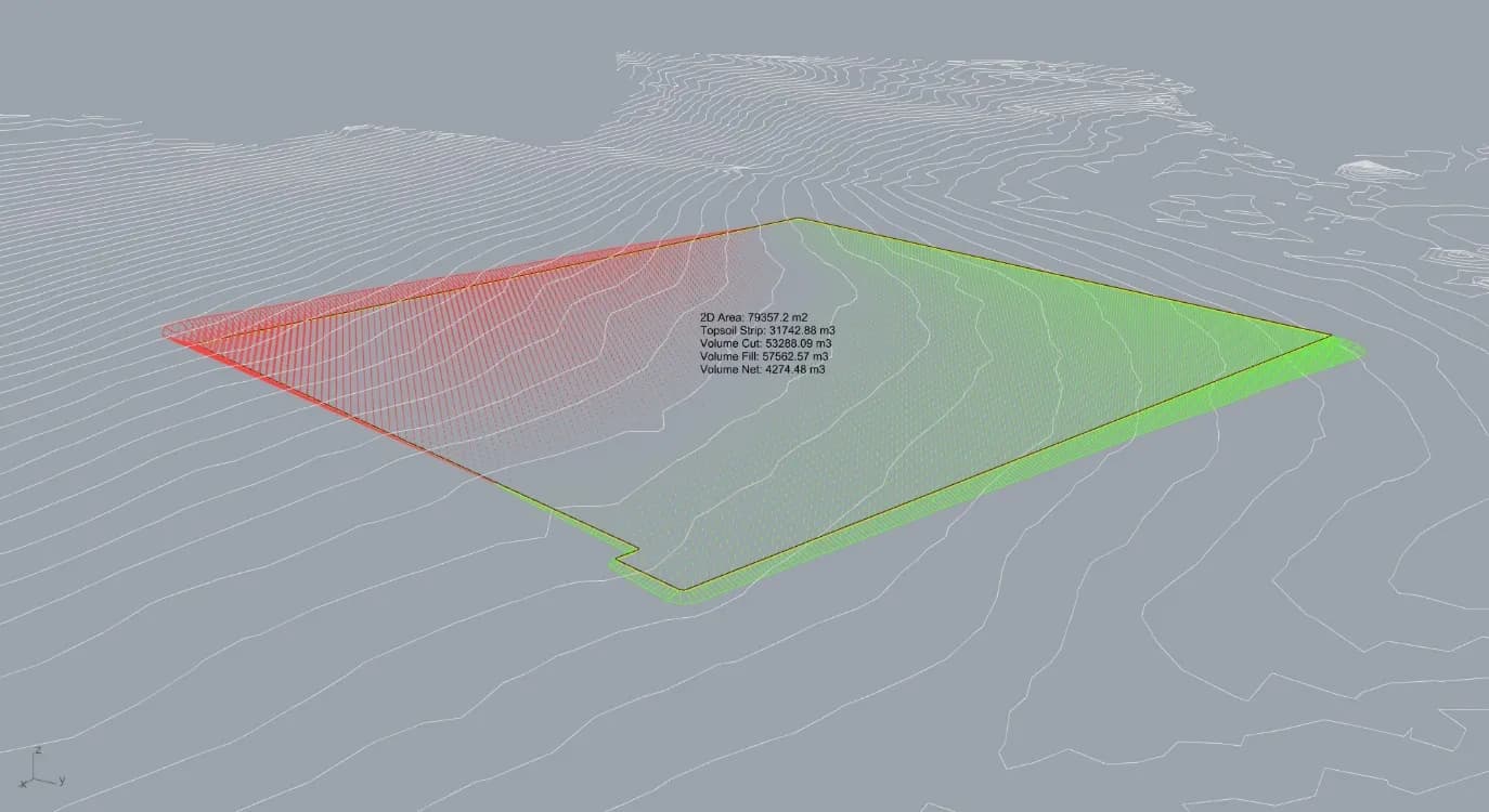
I studied Industrial Design at Victoria University of Wellington, including a research scholarship combining robotic fabrication with spatial 3D printing. Before moving to London I worked at Aurecon in Wellington on parametric earthworks, point cloud processing and geospatial delivery for wind farms, rail and housing. Alongside that I ran a 3D-printed product business for four years and build web applications, which is where the interest in making data usable rather than just correct comes from.
The overlap
Record
- Role
- Based
- Passport
- Organisations
- Entries
- Span
Built with
FMEGrasshopperRhinoArcGISGISBlenderArduinoCivil 3DGoogle Sheets APINext.jsSpeckleVercel
Parametric Earthworks Modelling
Contact
On this site. Downloads as a PDF from the page.
Recognition
- Digital Construction Team of the YearLondon Construction Awards2025
- VINCI Group Innovation Awards, Runner UpVINCI2026
- VINCI Group Innovation Awards, Special MentionVINCI2026
- Information Management PractitionerOperam Academy2026
- Value Award, ExcellenceTaylor Woodrow2025
- Best Case StudyTaylor Woodrow2025
- Innovation LeaderTaylor Woodrow2025