GRAI
Product Design, Haptic Interfaces, Accessibility
A fingertip-worn device that lets a blind or low-vision user feel terrain by touch: a light sensor reads the greyscale value of an elevation map under the fingertip and drives a vibration motor in proportion to it, so height becomes something felt rather than seen. Built with a project partner and shaped by feedback from Low Vision New Zealand.
- Drawing title
- Sheet 04-01
- Organisation
- Role
- Year
- Location
- Sector
- Status
- Built with
Background
INDN 341, Innovative Mediums. The brief was to envisage a device that integrates emerging technology with a real purpose, develop it, and build a working model. The idea that became GRAI started from New Zealand's landscape and the fact that nobody who cannot see it has a way to feel it: a handheld device, closer in spirit to a Newton's pin-art toy than a screen, that would use live GPS data to raise a 3D relief of the terrain around the user in real time.
The problem
A real-time pin array driven by GPS is a much bigger build than one trimester allows, and the project descoped twice rather than pretending otherwise. A grid of gear-driven actuators was built to test raising and lowering physical pins, then abandoned: the motors were expensive, needed one per pin, and the resolution that bought was poor.
The final version gave up moving anything at all and moved the resolution into the reading instead, which is the decision the whole project turns on. What survives is a working proof of that sensing principle on one fingertip, not the handheld device the brief opened with.
What I built
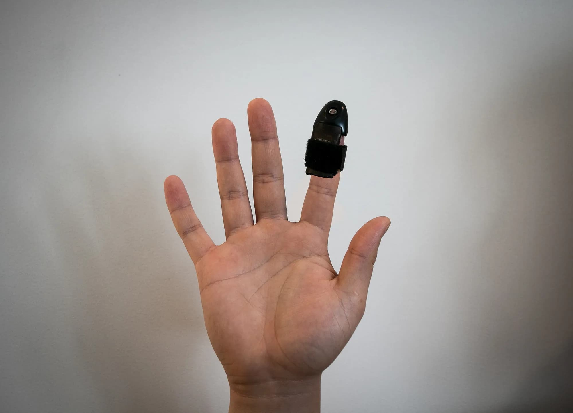
A 3D-printed sleeve worn on the index fingertip, held by a leather-backed strap, carrying a light sensor and a vibration motor driven by a microcontroller and a 5V battery.
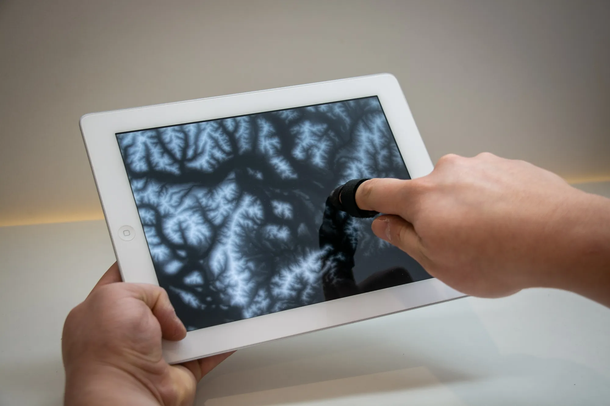
The mechanism is one clean substitution. The sensor reads the shade of grey directly beneath the fingertip as it moves across a greyscale elevation map on a screen, and that reading is remapped onto the motor's pulse width: dark is low ground and stays quiet, light is high ground and buzzes hard. Nothing about the map is converted into speech or sound. Elevation stays a continuous quantity and arrives as a continuous one, which is why tracing a ridgeline feels like a ridgeline rather than like being told about one.
Built with a project partner, and refined with feedback from a contact at Low Vision New Zealand, who confirmed that tactile feedback from a map was a real improvement over the audio feedback most existing tools rely on.
Outcome
The mechanism is simple and well argued in the original documentation: a light sensor standing in for a height reading, remapped directly to a vibration motor's pulse width, so that greyscale becomes elevation felt through one fingertip. It is also, unusually for a piece of coursework, a project sitting close to what this site's terrain and elevation work does professionally now, just arrived at from the opposite direction: reading the ground as data rather than turning data back into ground.
Where it goes next
The project's own future plans page called for removing the exterior wiring for a cleaner body, and for an app that could pan and zoom to any location rather than one fixed test image. Neither has been carried forward here.